
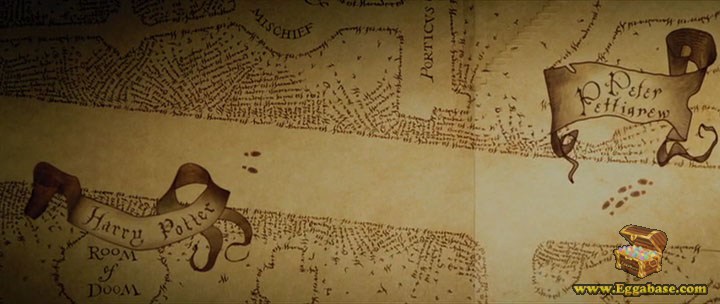
This follows on from last month’s post, in which we discussed the possibility of a future Shazam for People service and extends it to the concept of a ‘universal tracking system’ or real-world Marauder’s Map …

So, just how feasible is it?
Well, let’s start with a recap of what would be needed for Shazam for People (SfP), which is essentially:
- Collecting enough data (visual, chemical, electronic, etc.) from someone to form a personal fingerprint,
- Matching this against an online database (or using intelligent software to work around the absence of such an index for legal reasons) to identify the individual, and
- Returning all data for that person to the user of the SfP service.
In principle, a Real-World Marauder’s Map (RWMM) doesn’t need the (trivial) third part. (However, in practice, SfP and RWMM might be expected to work together before long.) For individual identification only, it just needs the clever hardware in (1) and the clever software in (2). Another way of putting it is to say that it needs ‘Big Connectivity’, where:
Big Connectivity = Big Data + Internet of Things (IoT)
(see The Real Internet of Things)

But RWMM needs more because this stripped down SfP only gives us real-time-anywhere (RTA) identification and placement of an individual. RWMM needs RTA identification and placement of everyone. How much of a tall-order is that?
Well, it may not be as bad as it sounds because, if we have an operational SfP system and it’s running wherever we need RWMM to work then we already have the raw data being uploaded to the system. All that’s required is for this information to be fed back in coordinated form to the users of the system. The large quantities of information for an individual in SfP are replaced by much smaller tagging information … but for everyone in RWMM.
In a way, this is similar to an existing real-time traffic alert system in some cars, in which vehicles are both the providers of raw data and users of processed information. In fact, just as with a traffic system, RWMM users would probably only need a ‘local’ view, either of their immediate surroundings or those of an identified location or individual.
But, in fact, RWMM doesn’t have to rely directly on SfP to support it. Data for the identification of individuals can be captured anywhere: cameras in the street, electronic scanning at service points, chemical analysis at entrances/exits, etc. As IoT hardware gets more sensitive and the matching/identification software gets cleverer, individual identification will become easier. (Remember all the options for identification in the previous post.) Maintaining a global database and feeding this out to anyone wishing to use ‘the map’ will be trivial (although also possibly illegal – we’ll discuss this in a separate post).
In terms of the Big Connectivity equation, to make a ‘universal tracking system’ a reality, we’ll need advances in both the hardware and software, simply to deal with the scale, reliability and accuracy required. Rather than simply identifying a single individual RTA, we’ll need to identify everyone RTA. In other words, we need:
(Big Data + IoT)2 = Big Connectivity2
or possibly just
Big Data2 + IoT2
(It’s not a real equation!)
But this might not be that much to ask as time goes by?
Just a thought!


January 6th, 2016 at 1:10 pm
[…] and Privacy: Big Data + the Internet of Things = ‘Big Connectivity’. It will be very hard in future to keep anything secret. What effect will that have on us […]
September 15th, 2016 at 11:17 am
[…] this is an area, which we’ve discussed before – many times so we won’t repeat old material. But, essentially, our data is very valuable. Not just to […]
February 14th, 2017 at 11:25 am
[…] global record of where everyone had ever gone– and when (see A Real “Marauder’s Map”?) and thus, in turn […]
October 1st, 2018 at 12:13 pm
[…] that was extended, through other articles; The ‘Prof on a Train’ Game and A Real Marauder’s Map, to describe a future in which none of us would have any privacy at all. Maybe it seemed a bit […]
May 15th, 2019 at 9:46 am
[…] A Real “Marauder’s Map”? […]